Penta Pano
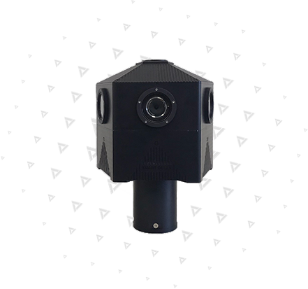
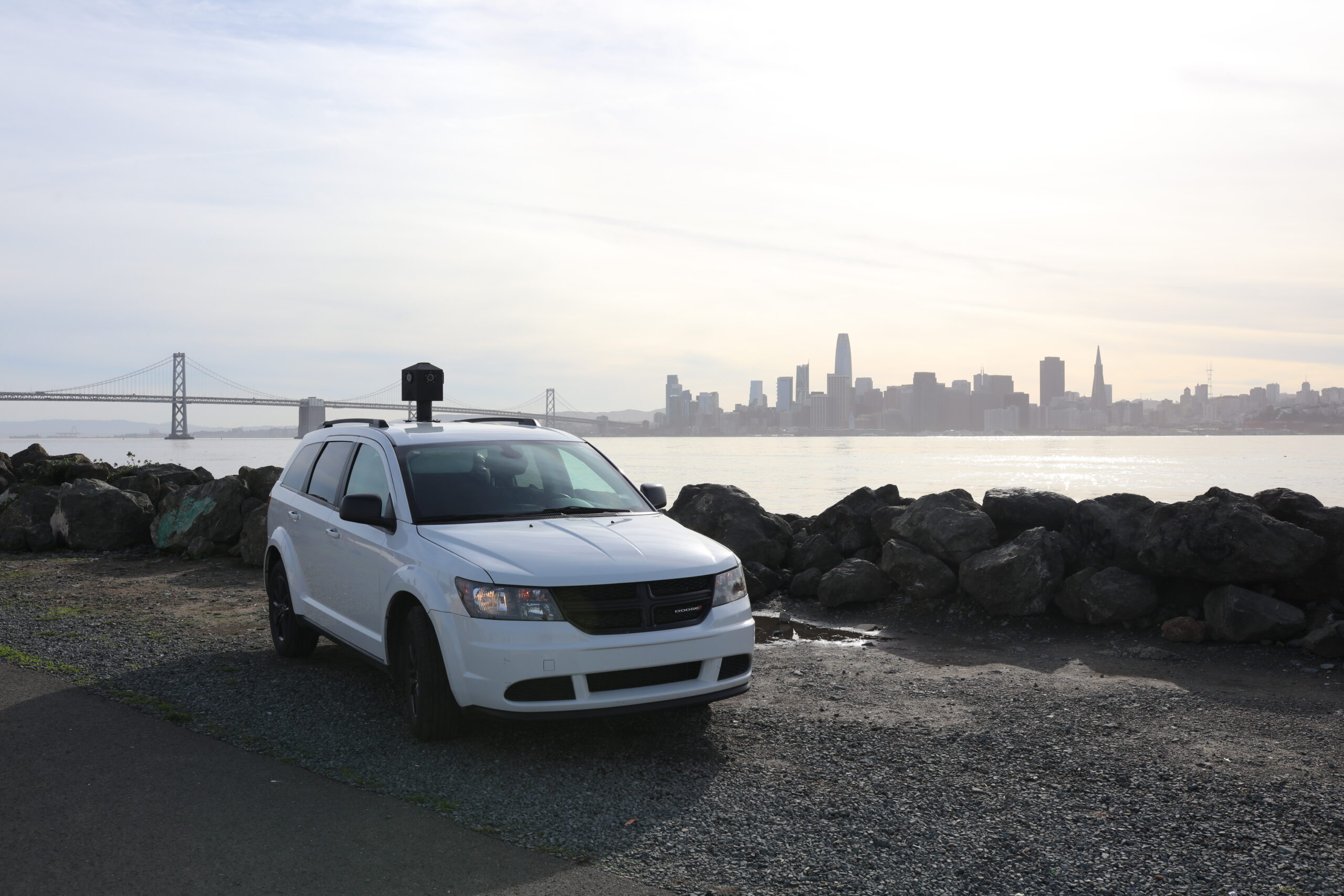
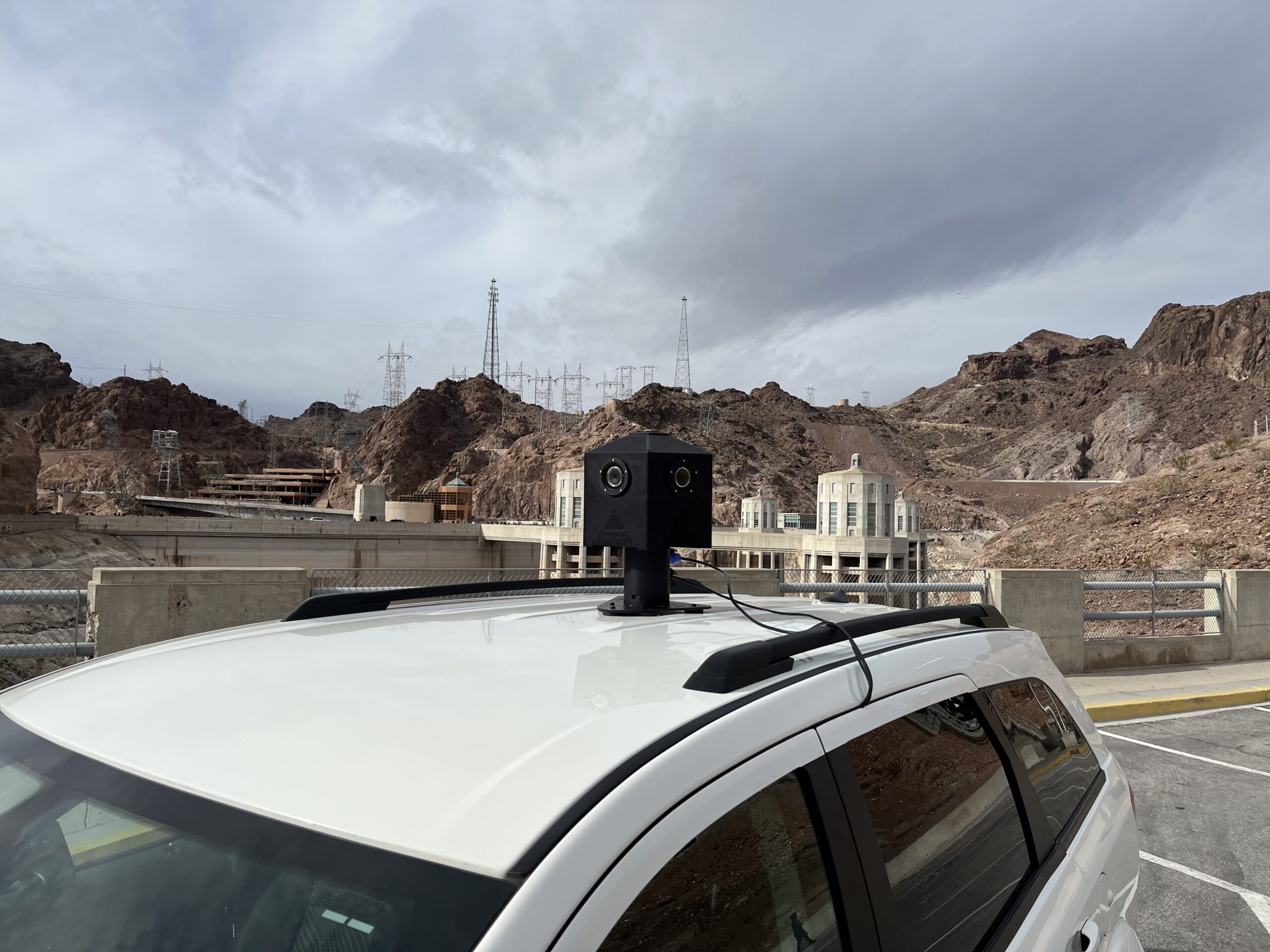
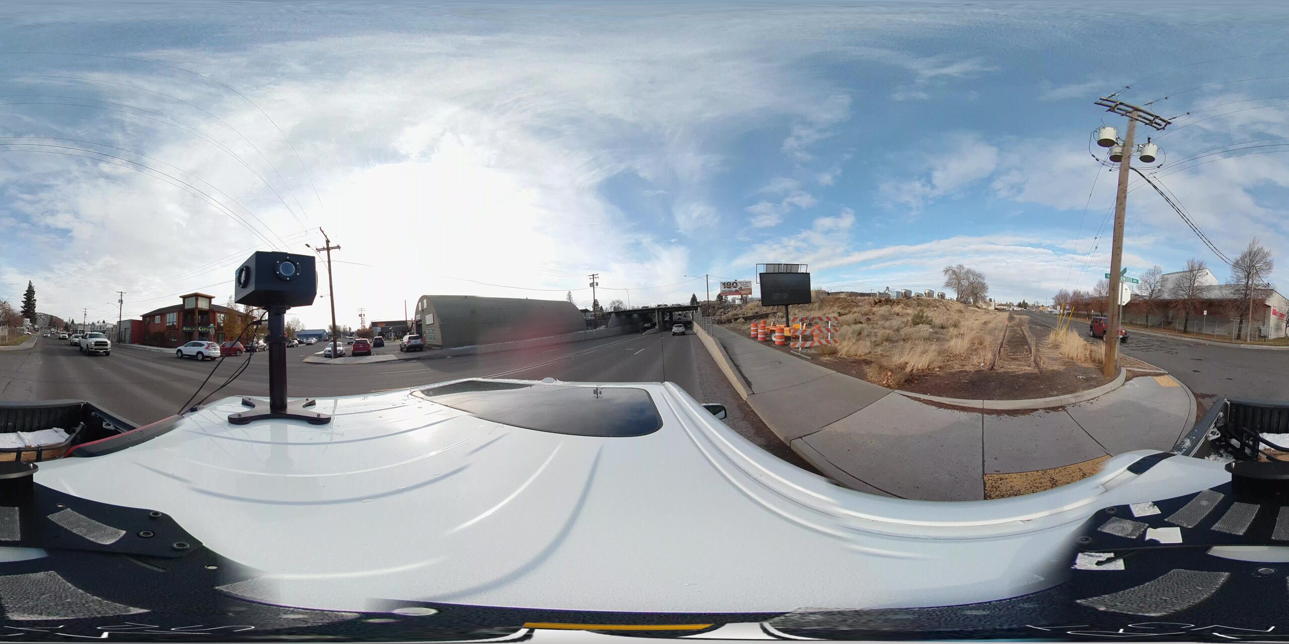
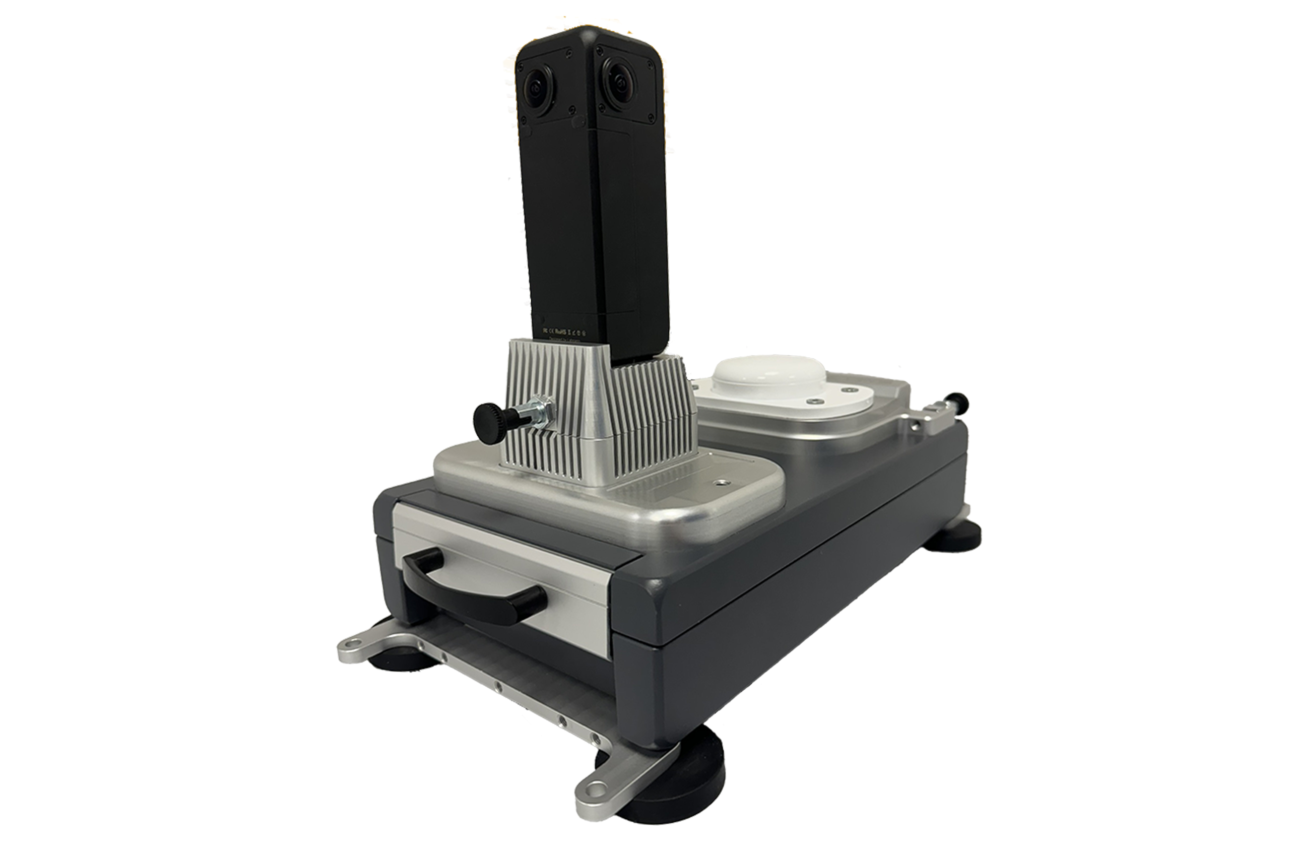
The Smartdelta 150 Megapixel “Pentapano” 360 ° is a robust standalone 360 ° global shutter camera built in collaboration with our partner Nedinsco.
The Pentapano is one of the highest resolution 360 ° camera’s currently available and is equipped with real time automatic image optimisation, integrated processing unit, swappable SSD, high presision gps/Ins Combo for optimal positioning and altitude accuracy and 1 MS accurate GPS PPS timestamping via the on board Geotagger™
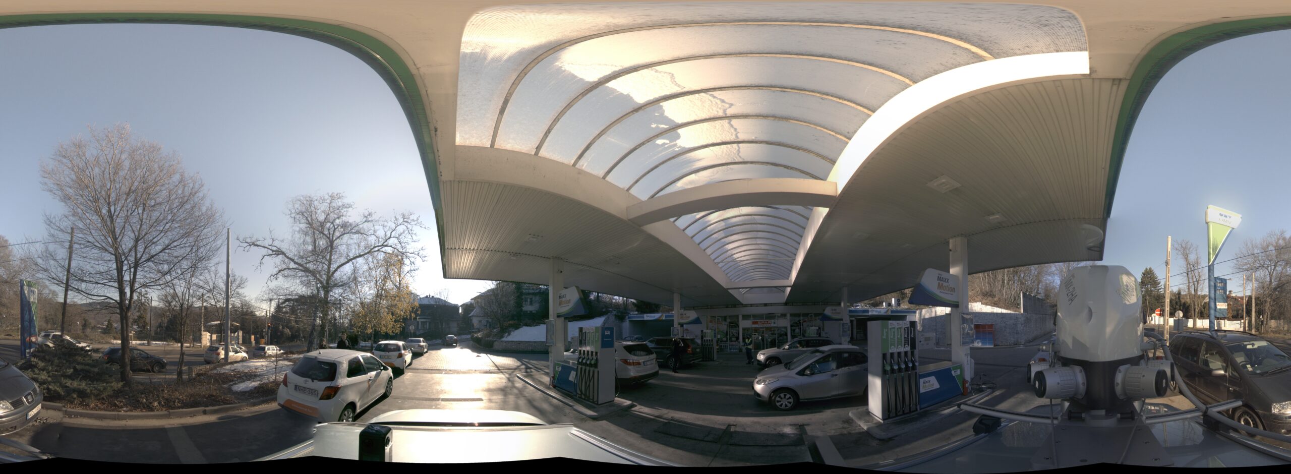
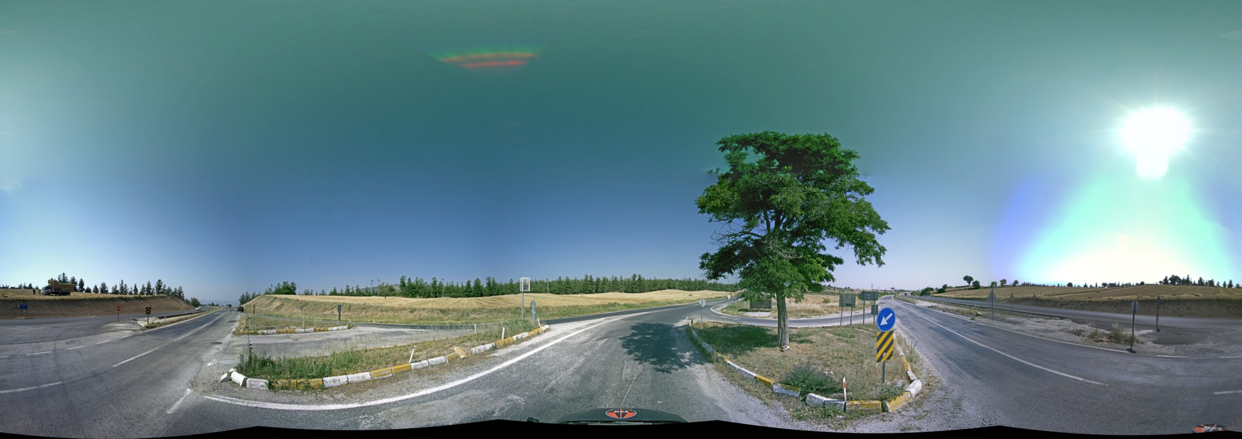
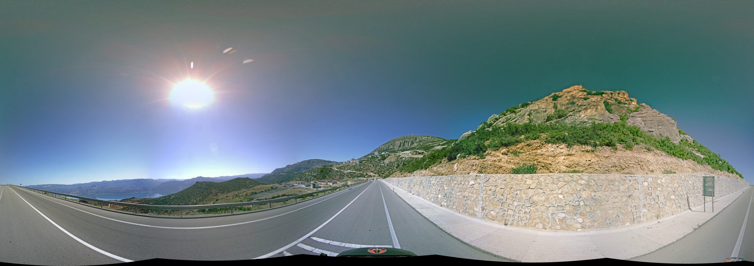
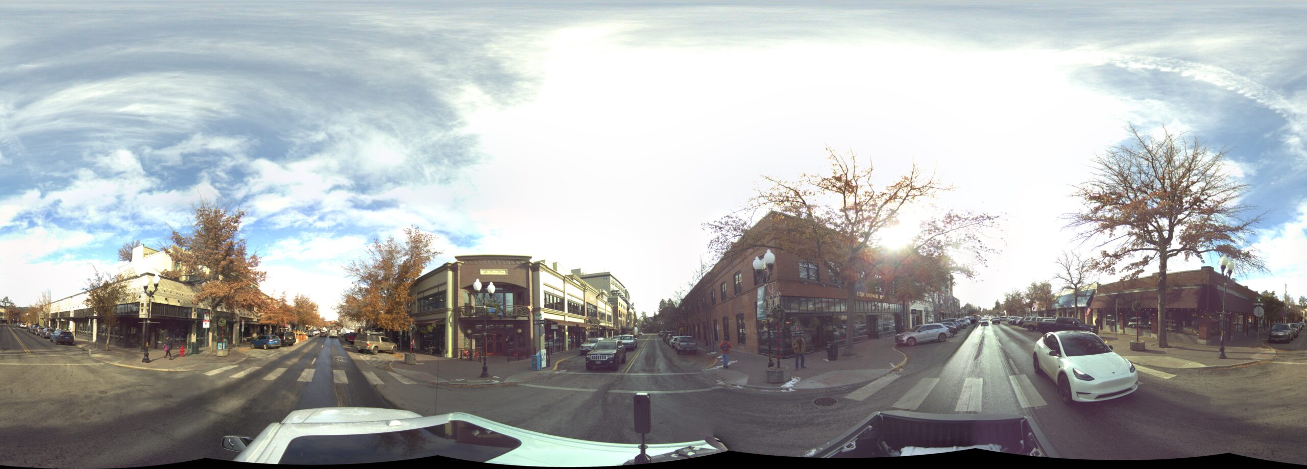
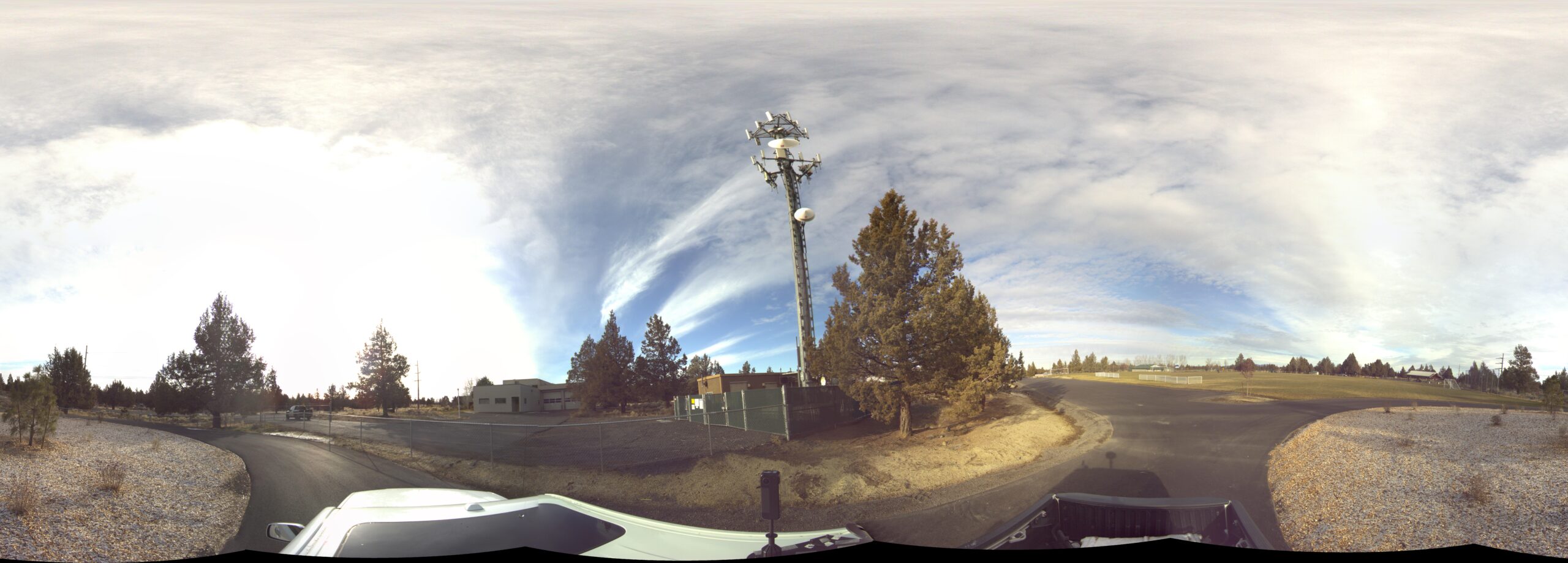
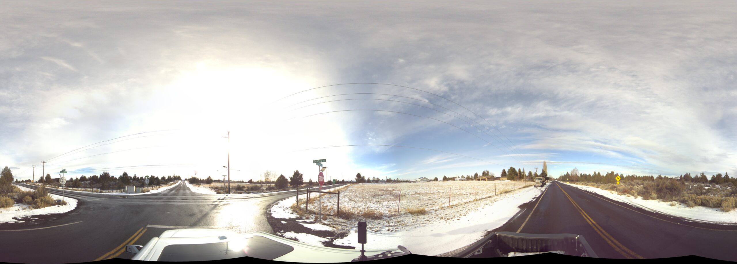
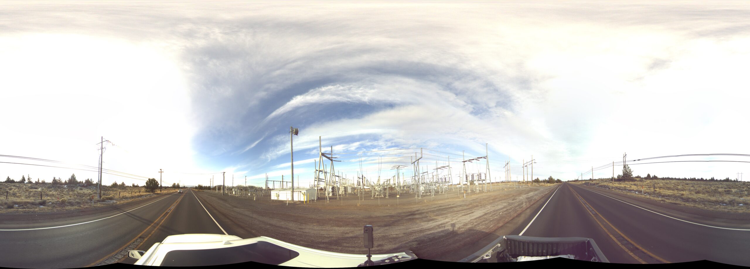
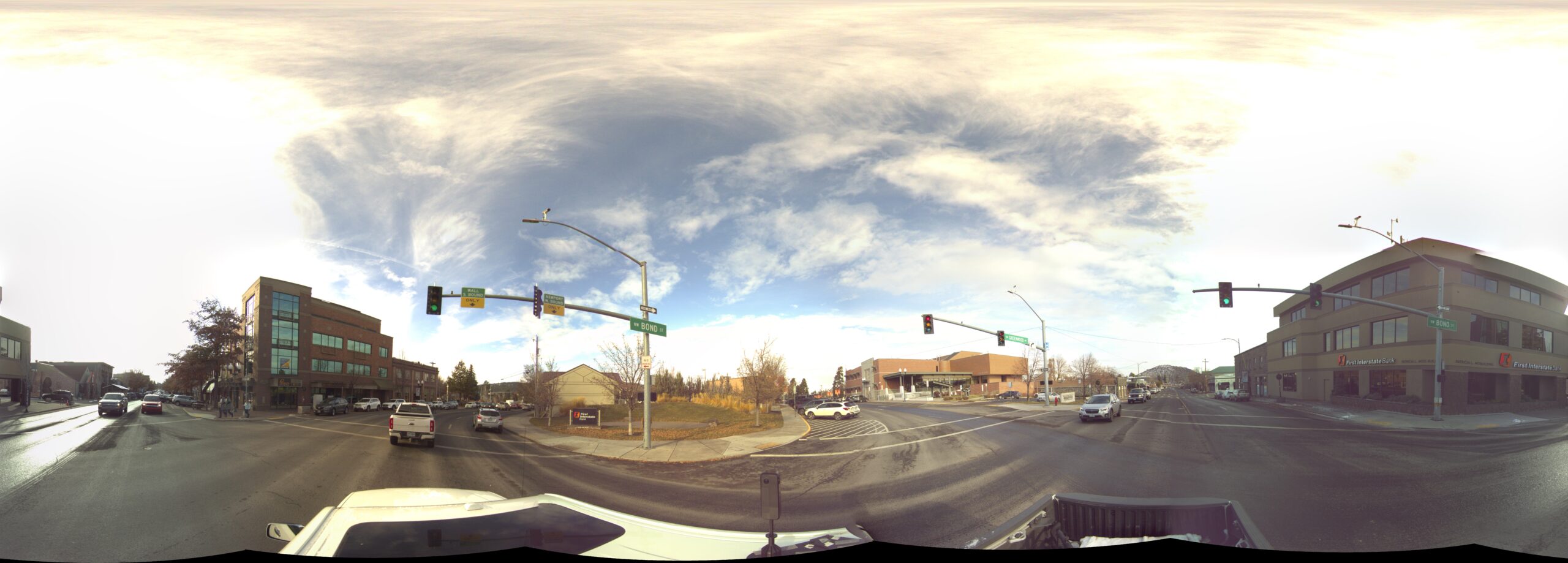
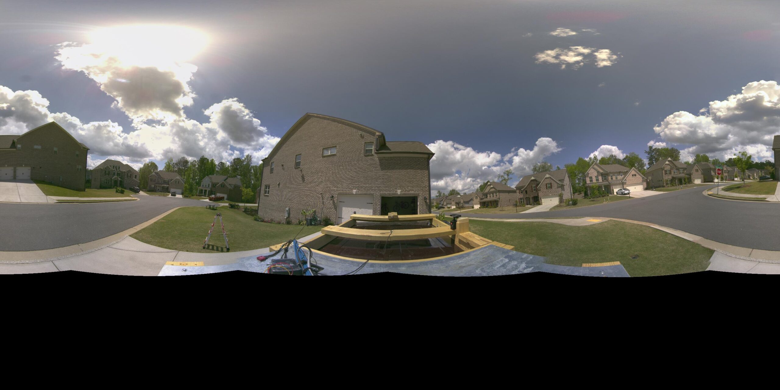
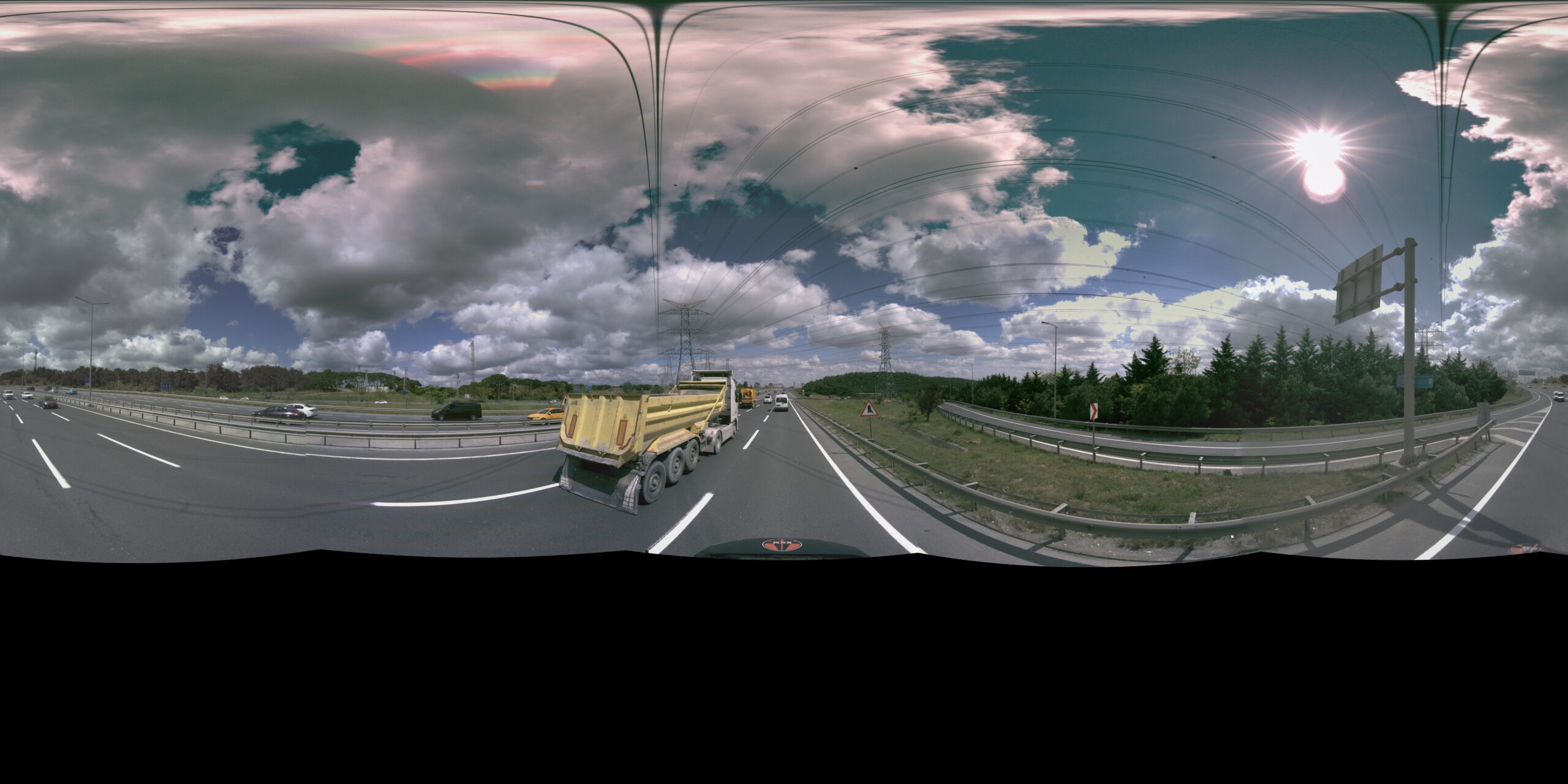
The Pentapano has been compiled based on customer requirements and recommendations and therefor ensures maximum quality and usability within different use cases, like for example Mobile Mapping, Asset inspection and analysis and Surveying.
- Ultra high resolution images
- Alluminium body
- 6x 5120x5120 synchronized images
- external and internal trigger mode
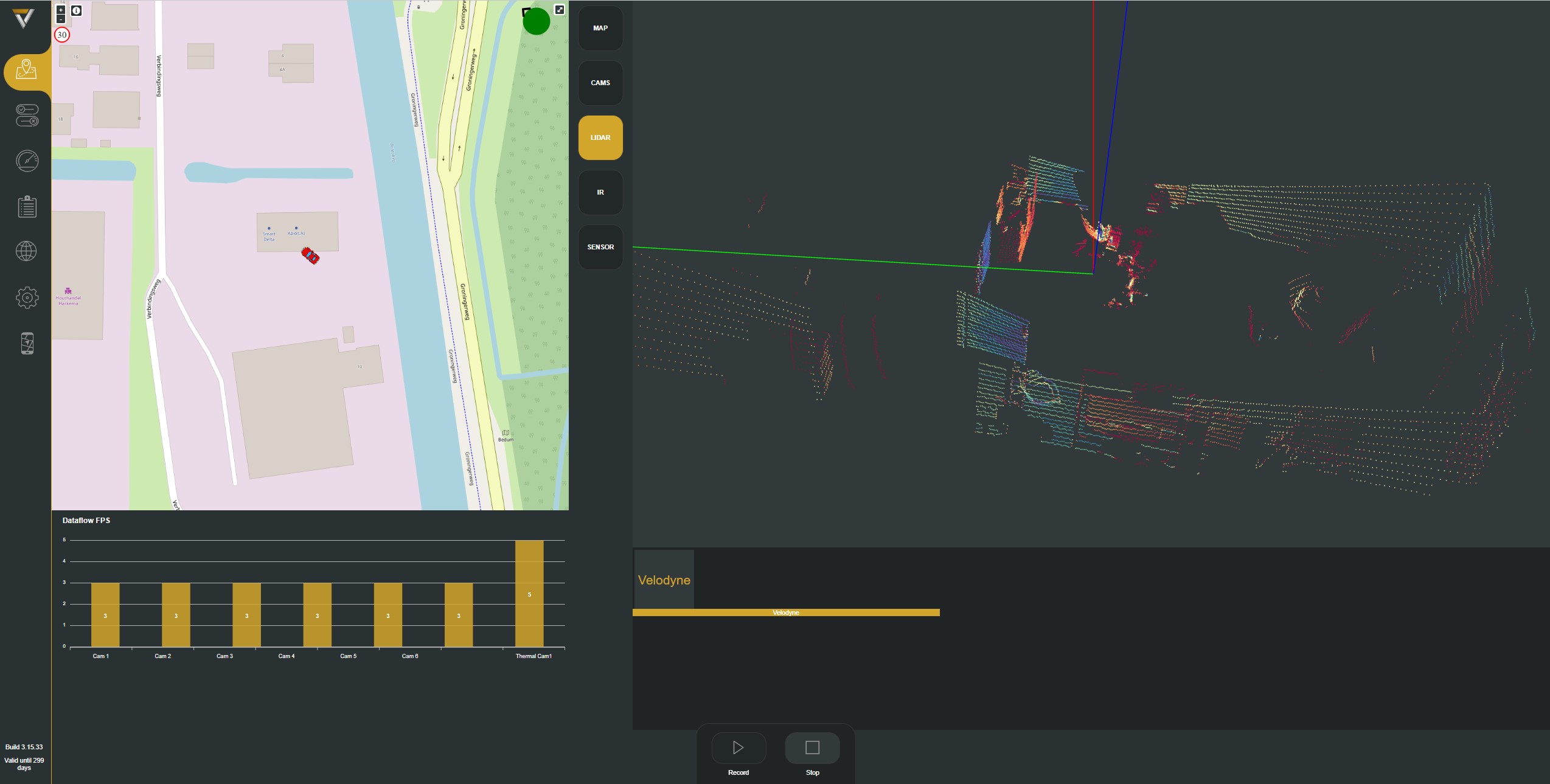
- Embedded RTK GPS
- Build in Processor ans SSD storage
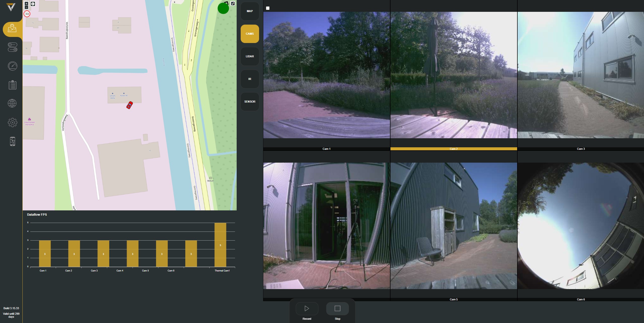
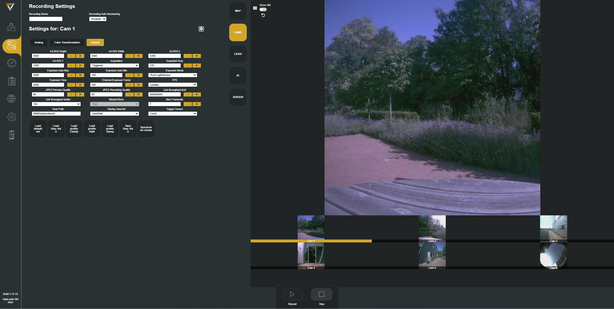
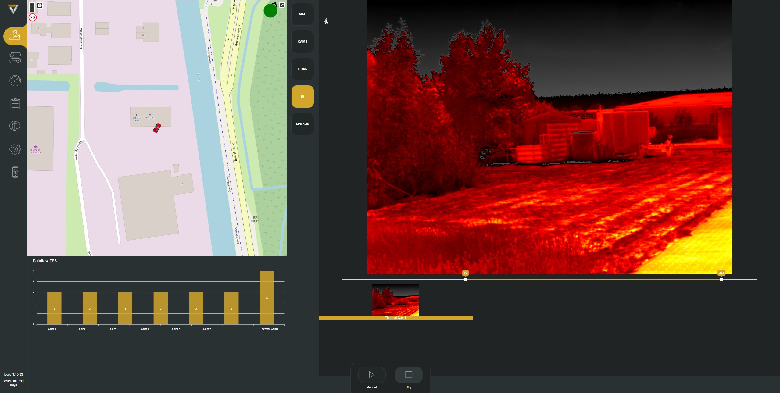
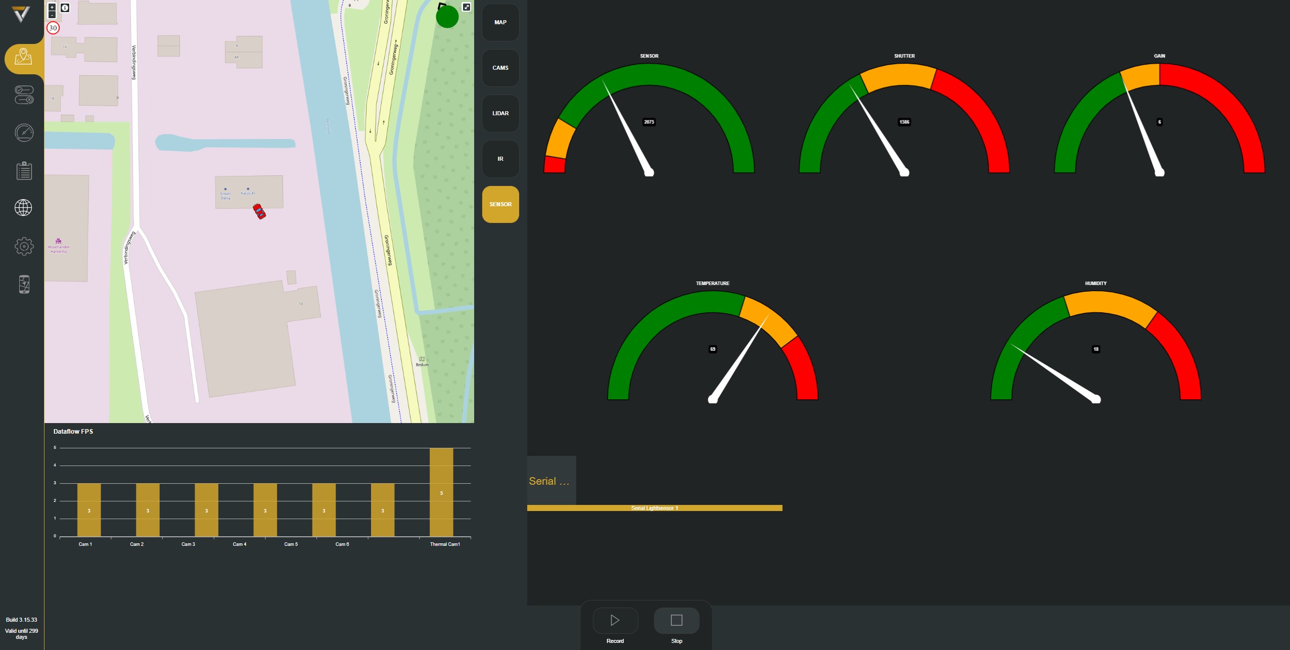
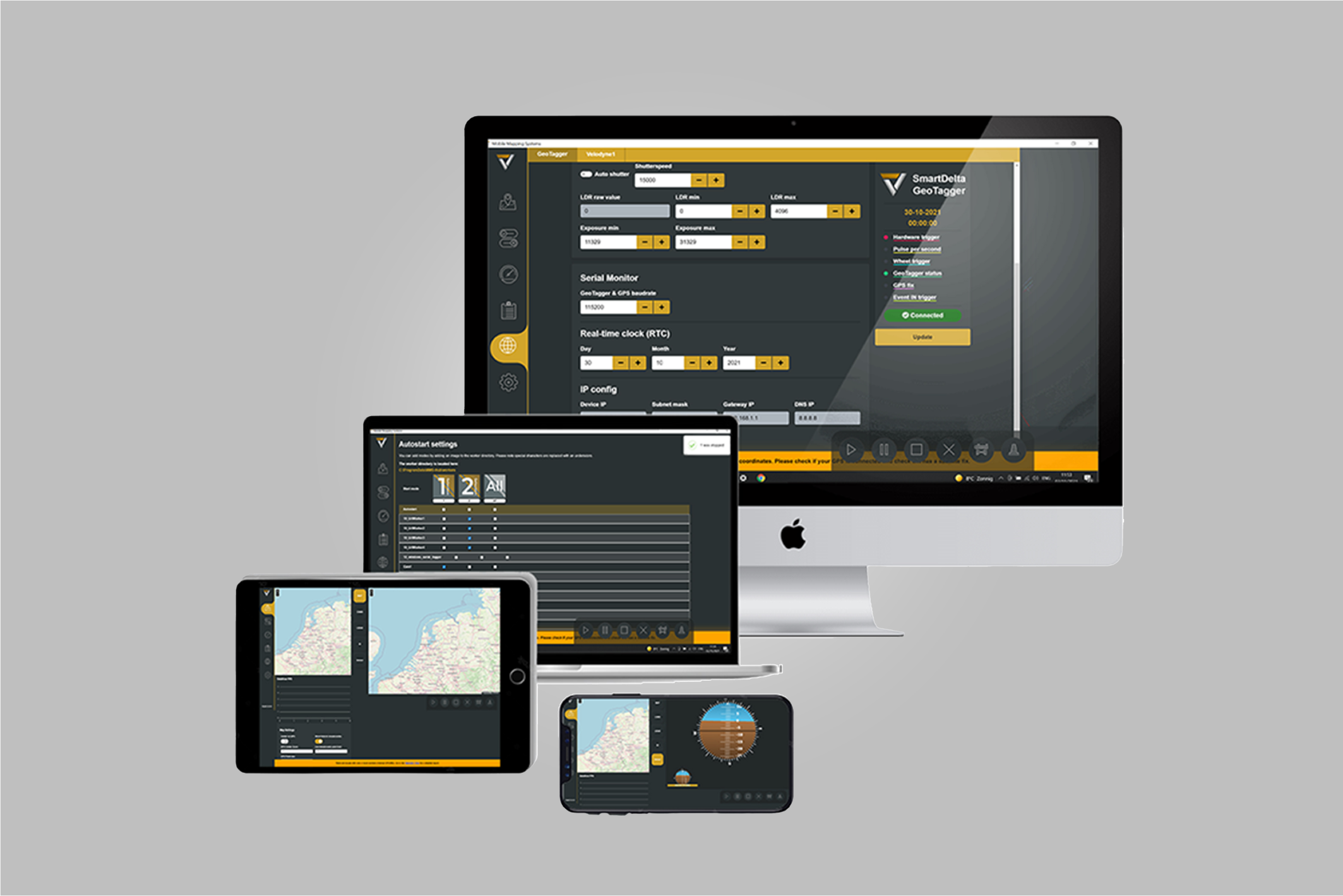
- Bowser based control and recording
"Capture the world in stunning detail and accuracy, empowering you to unlock endless possibilities in geospatial data collection and analysis."

Data sheet
Resolution 5120 x 5120?
Megapixels 157.2
Sensor name Gpixel GMAXO505
Sensor type Cmos
Sensor format 1.1 inch
Readout method Global shutter
Pixel size 2.5 x 2.5 micro m
Frame rate 5 FPS
Trigger modes Internal, external, freerun
ADC 8 Bit 12 Bit
Dynamic range db 70
Chroma Color
Color Anodized black
Power requirements 19-V 9 ampere
Power consumption 171 Watt
Cooling Active cooling
GPS antenna L1 + L2
Dimensions
Camera (max width x height) 300 x 270 mm
mount (width x height) 110 x 140 mm
Weight 12.3 KG
System configuration
CPU Intel NUC i7 12th gen, 16 GB ram DDR4,
500 GB SSD, NVMe ( x 2)
Operating System Linux Ubuntu
Port USB 3
Memory Swappable SSD 2 TB standard
Videocard Intel Iris XE Graphics
Software Stitcher: supports Hugin and Open CV
camera model (*currently available for free)
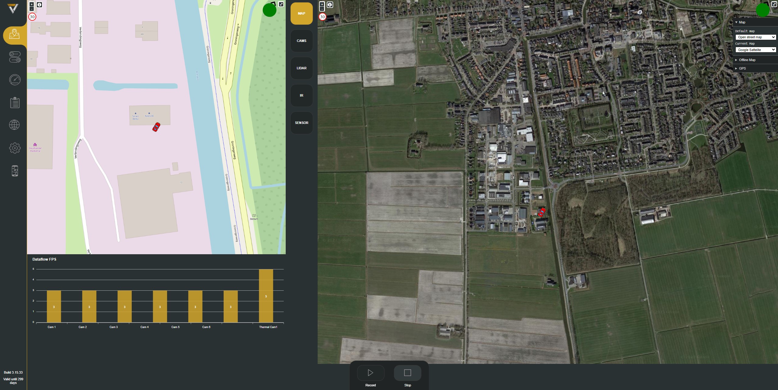
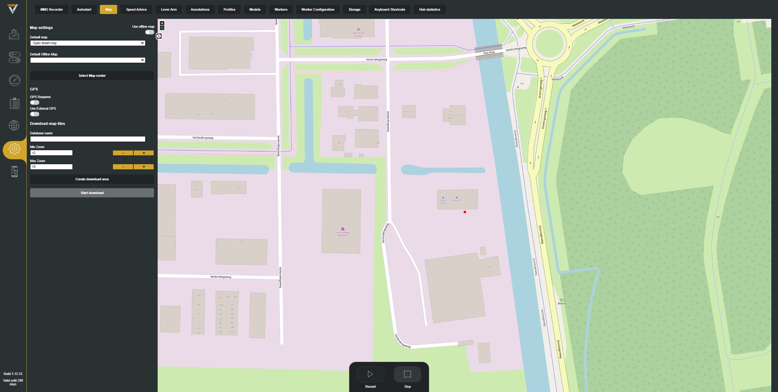
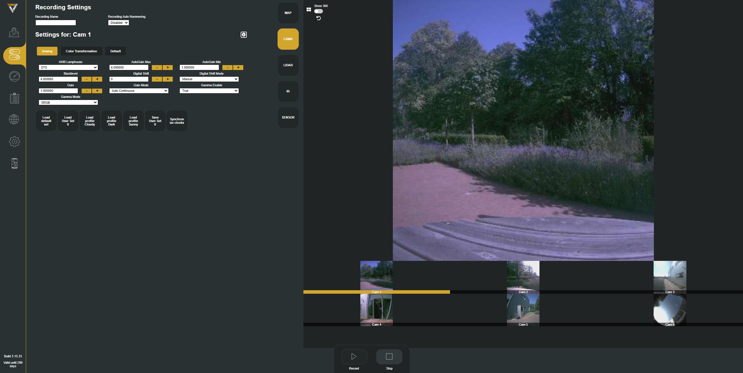
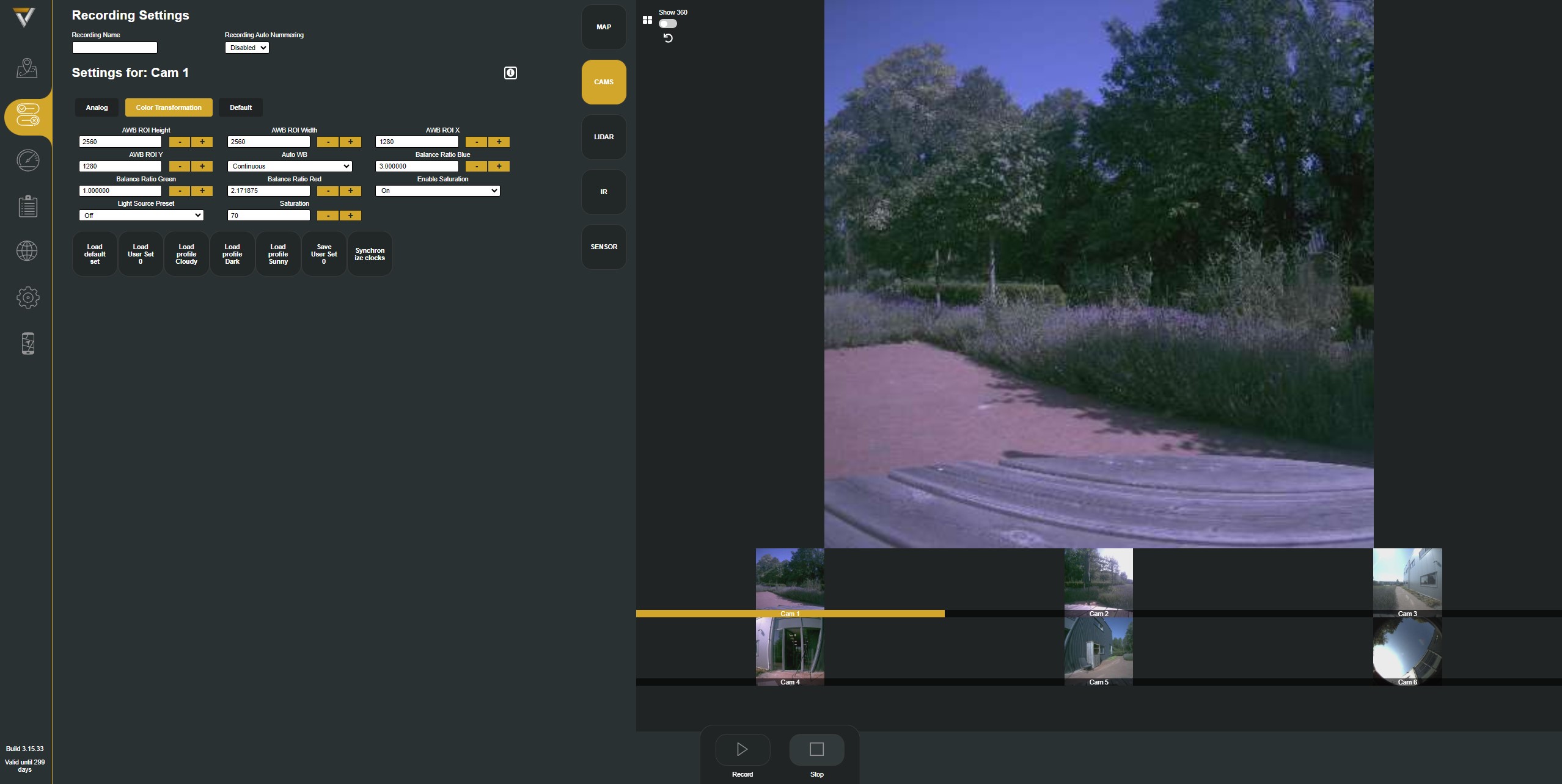
Recommended software Smartdelta MMS (mobile Mapping Software)*
Atlant Gis software*
*Additional charge, annual license fee
External hardware Support for additional hardware at request
Warranty 2 years
Web browser like Chrome or Edge.
network connection

Penta Pano
Discover the game-changing power of our 360-degree 150-megapixel camera system for mobile mapping. Unleash unrivaled precision and detail, capturing the world with breathtaking clarity and opening new frontiers in geospatial data collection and analysis. Redefine your mapping projects with cutting-edge technology and witness the future of mobile mapping unfold before your eyes.
Explore other systems
- High quality images with 8K 48 Mpix resolution
- Accurate record of its position and time
- Easy to use mobile mapping system
- Easy-to-use mobile recording software
- Supports workers using various sensors to communicate with the software
- Ideal for a with range of industries
- User-friendly solution for creating seamless panoramas
- Compatible with Windows and Linux operating systems
- Supported images formarts: JPEG, PNG, TIFF RAW and more