News

Smart Delta Systems & Solutions appoints 4D Global as First Official Reseller for SmartPano Gen2 in Asia Pacific

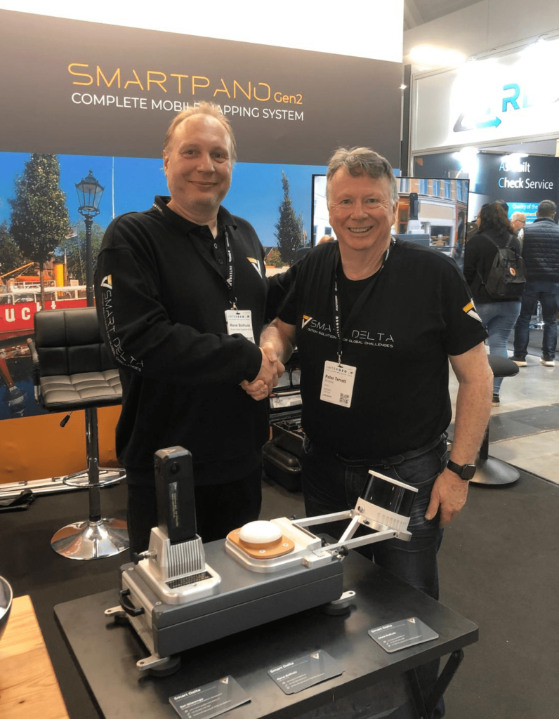
Smart Delta, a global leader in advanced mobile mapping technology, proudly announces its partnership with 4D Global as the first official reseller of the revolutionary SmartPano Gen2 360 Mobile Mapping System. This strategic collaboration expands Smart Delta’s reach into the Australia, New Zealand, and Pacific Islands markets, delivering innovative mapping technology to a broader audience in the Asia Pacific region.
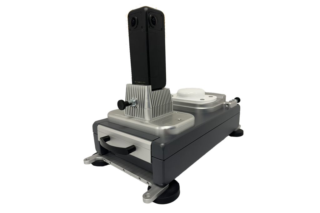
The SmartPano Gen2 is an industry-defining solution, offering RTK-level accuracy in a portable design that fits into hand luggage—even when equipped with LiDAR. Its unmatched portability, precision, and affordability are set to transform the mobile mapping landscape for infrastructure, asset management, and road network projects.

Revolutionizing Mobile Mapping: The SmartPano Gen2

Designed to make high-precision mobile mapping more accessible and efficient, the SmartPano Gen2 delivers exceptional accuracy in a compact system that can be easily transported and set up in minutes. The system connects to any standard vehicle using four magnetic mounts, simplifying deployment for operators in the field. Powered by two interconnected power banks, the SmartPano Gen2 enables a full day of uninterrupted mapping, eliminating the need for recharging or external power sources. Data is securely stored on a swappable SSD, ensuring peace of mind for operators working on critical projects. One of the standout features of the system is the Mobile Mapping Software (MMS), which offers a user-friendly interface that allows even operators with no prior mobile mapping experience to collect data effortlessly. Customizable and remotely configurable software settings further simplify the process, making the SmartPano Gen2 an ideal solution for businesses seeking to optimize their mobile mapping workflows.

Expanding Smart Delta’s Reach in Asia Pacific

The appointment of 4D Global as the official reseller for the Asia Pacific region is a pivotal move for Smart Delta as it continues to extend its presence in key international markets. By partnering with 4D Global, Smart Delta is committed to providing first-class service and support to its customers across Australia, New Zealand, and the Pacific Islands.
We are excited to collaborate with 4D Global, a trusted leader in geospatial solutions with deep market expertise in Australia,” said Rene Bolhuis, CEO of Smart Delta. “This partnership aligns with our goal of delivering innovative mobile mapping technology to a wider audience while ensuring exceptional customer support. With the SmartPano Gen2, we are redefining mobile mapping by making it more accessible, accurate, and affordable for users across various sectors.

4D Global’s Vision: Empowering Businesses with Smarter Mapping Solutions

With more than 30 years of experience in the geospatial industry, 4D Global is well- positioned to lead the charge in delivering SmartPano Gen2 to businesses and government agencies across the region. Peter Terrett, Managing Director of 4D Global, emphasized the value that this collaboration brings to their customers:
“The SmartPano Gen2 represents a breakthrough in mobile mapping technology. We have been working with high-end mobile mapping systems for years, but the SmartPano Gen2 offers a unique combination of affordability, simplicity, and accuracy. It is a game changer for businesses looking to reduce both the cost and complexity of their mapping operations by a factor of four. This addition to our portfolio strengthens our commitment to offering innovative spatial solutions that help our clients optimize their infrastructure and asset management workflows.”

About Smart Delta Systems & Solutions

Smart Delta is a global innovator in mobile mapping technology, providing advanced geospatial solutions that set new standards for accuracy, efficiency, and ease of use. Smart Delta’s portfolio of products serves industries such as infrastructure, transportation, asset management, and urban planning. With its groundbreaking technologies like the SmartPano Gen2, Smart Delta continues to push the boundaries of what is possible in mobile mapping and spatial data collection.

About 4D Global

Founded in 1991, 4D Global is a leading provider of spatial data solutions with over three decades of expertise in the industry. The company offers innovative products that enhance the efficiency of collecting spatial information about both the built and natural environments. Starting as a GPS supplier, 4D Global has evolved into a comprehensive solutions provider, offering innovative technologies that deliver superior outcomes for clients across various sectors.

Movella: SmartDelta opens up the market with the 2nd generation SmartPano.

Mobile mapping is big business. Amongst other, the automotive industry relies on continually updated visual and geospatial data to enable consumer-friendly features such as satellite navigation and location-aware speed limit information. New driving assistance and automated driving functions require even more detailed data about roads and traffic. Search and mapping services for computers and mobile phones also draw on a huge global data store of geolocated images.

Read more on the Movella website: https://t.ly/889y9

SmartDelta and Mosaic – Geospatial Imaging Leaders

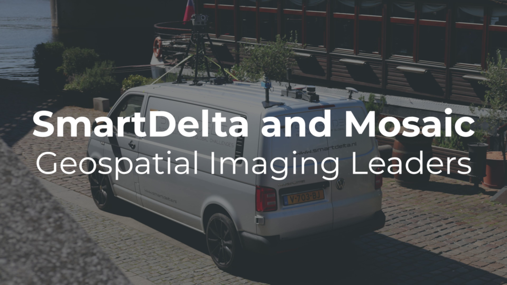
SmartDelta and Mosaic – Geospatial Imaging Leaders testing out a multi-sensor mobile mapping system including the Mosaic X camera, LiDAR, high-precision GNSS, and thermal camera, all collected with the Smart Delta mobile mapping software which enables users to pair high quality imagery with other high-end sensors according to their needs.

https://www.mosaic51.com/ and https://smartdelta.nl/

SmartDelta released it’s new website

SmartDelta released their brand new website!

in the Self Support section you can find lots of useful info and sample data.


check it out on ww.smartdelta.nl


SmartDelta sold its first mobile mapping vehicle

SmartDelta has sold its first mobile mapping vehicle based on the MMR software. The MMR software provides open data that can be directly used in all kinds of external applications. It supports #camera #GPS, Lidar, GPR and Profilers. All in all, it is the perfect solution for data recovery projects.

Road Inspection 2.0 Dutch national highway

Receives subsidy for the following activity(s): The road network is critical to economies. Despite the introduction of road inspection vehicles, maintenance and inspection of the Dutch national highway network of 5357 kilometers alone is an enormously time-consuming task. The current road inspection equipment focuses mainly on inspection of the road surface quality and is stored in the inspection vehicle and later read out and manually processed into information for road inspectors from, for example, Rijkswaterstaat. In order to accelerate both the speed of the inspection (100 km/h) and the accessibility of road surface data and to broaden the road surface data to a complete road image (road surface, crash barrier, road signs, verge), Smart Delta wants to develop road inspection 2.0. This allows roads to be inspected faster and more efficiently.

The project is co-funded under the Union’s response to the COVID-19 pandemic.