
Smart Delta is all about sensor fusion
Smart Delta is a company specialized in sensor fusion. We combine information from various sensors to gain a more complete understanding of the environment or system being observed. This may involve combining data from cameras, radars, lidar and other sensors to better understand what is happening around a vehicle, such as detecting obstacles, traffic lights, and other vehicles on the road.
This technology can be applied in various fields such as autonomous vehicles, drones, military applications, surveillance systems and more. By integrating and analyzing data from different sensors, a company that specializes in sensor fusion can provide valuable information that can be used to make decisions, reduce risks, and improve performance.
Our systems
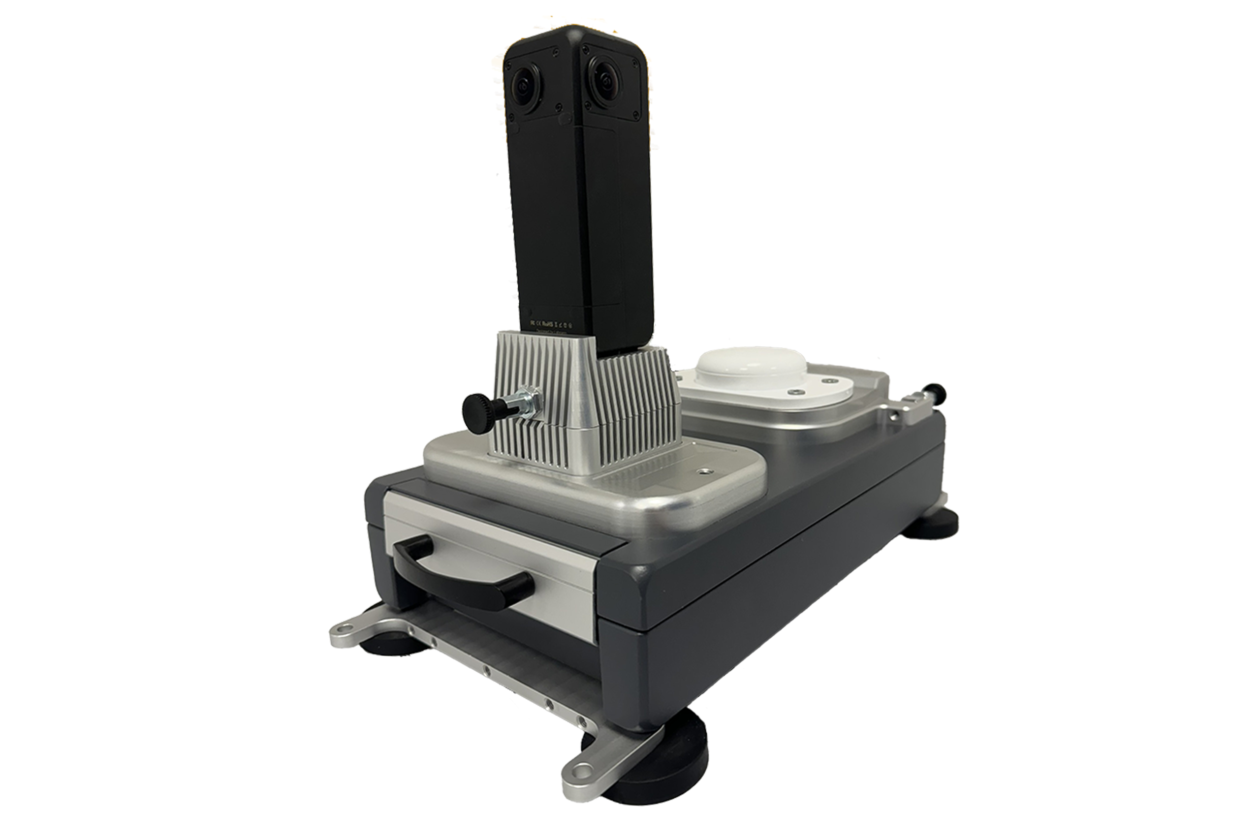
At Smart Delta, we understand the importance of accurate and efficient mobile mapping, whether you’re conducting surveys, mapping out urban areas, or monitoring infrastructure. That’s why we offer a range of cutting-edge mobile mapping systems and software solutions that are designed to meet the needs of businesses and organizations in a variety of industries.
- Easy-to-use mobile recording software
- Supports workers using various sensors to communicate with the software
- Ideal for a with range of industries
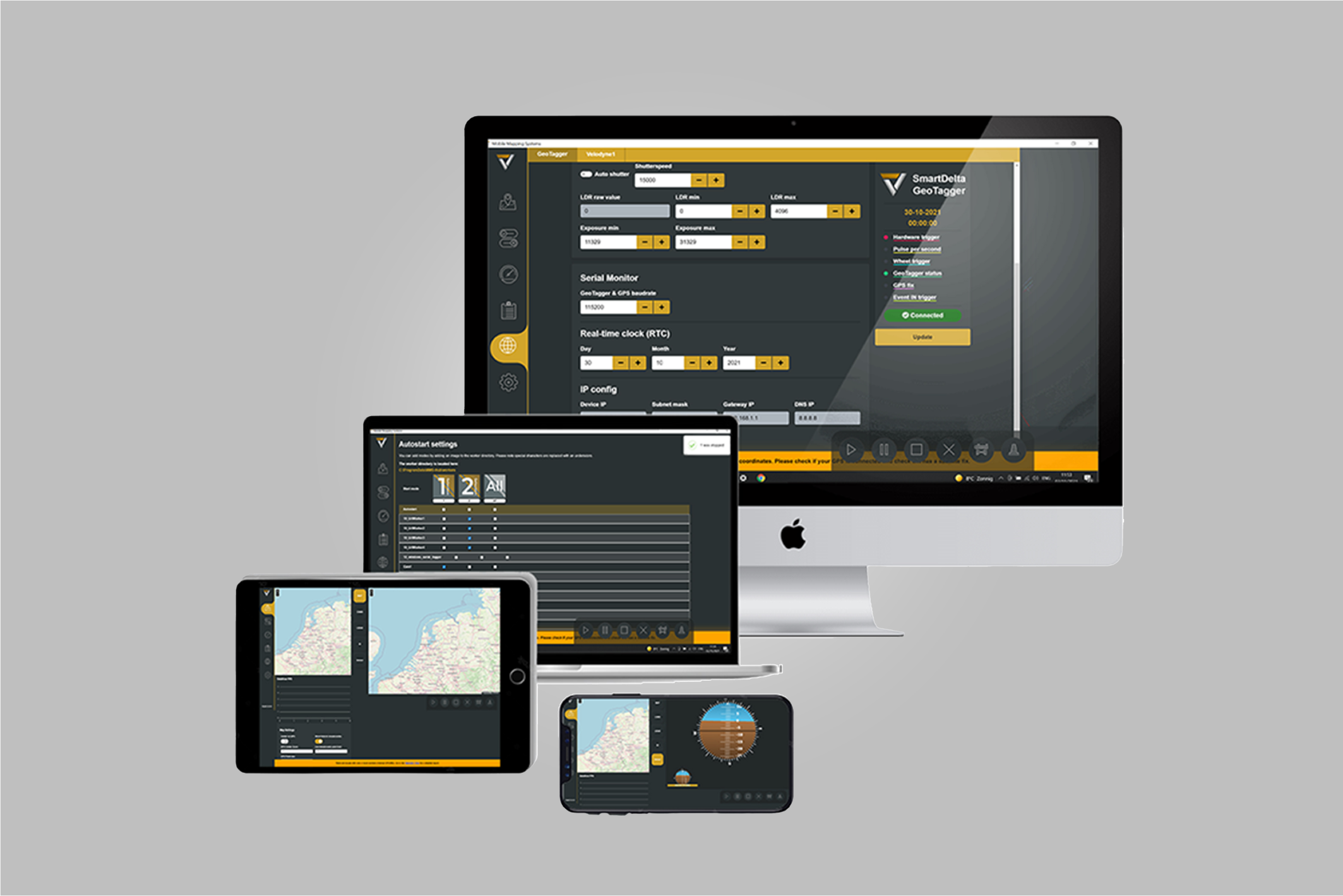
- User-friendly solution for creating seamless panoramas
- Compatible with Windows and Linux operating systems
- Supported images formarts: JPEG, PNG, TIFF RAW and more
- High quality images with 8K 48 Mpix resolution
- Accurate record of its position and time
- Easy to use mobile mapping system
Our solutions
Smart Delta is a company specialized in sensor fusion. We combine information from various sensors to gain a more complete understanding of the environment or system being observed. This may involve combining data from cameras, radars, lidar and other sensors to better understand what is happening around a vehicle, such as detecting obstacles, traffic lights, and other vehicles on the road.
This technology can be applied in various fields such as autonomous vehicles, drones, military applications, surveillance systems and more. By integrating and analyzing data from different sensors, a company that specializes in sensor fusion can provide valuable information that can be used to make decisions, reduce risks, and improve performance.
Latest Articles
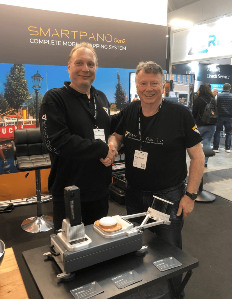
Smart Delta Systems & Solutions appoints 4D Global as First Official Reseller for SmartPano Gen2 in Asia Pacific
Revolutionizing Mobile Mapping: The SmartPano Gen2
Expanding Smart Delta’s Reach in Asia Pacific
4D Global’s Vision: Empowering Businesses with Smarter Mapping Solutions
About Smart Delta Systems & Solutions
About 4D Global

Movella: SmartDelta opens up the market with the 2nd generation SmartPano.
Mobile mapping is big business. Amongst other, the automotive industry relies on continually updated visual and geospatial data to enable consumer-friendly features such as satellite navigation and location-aware speed limit information. New driving assistance and automated driving functions require even more detailed data about roads and traffic. Search and mapping services for computers and mobile phones also draw on a huge global data store of geolocated images.
Read more on the Movella website: https://t.ly/889y9